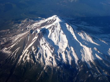
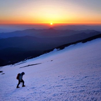
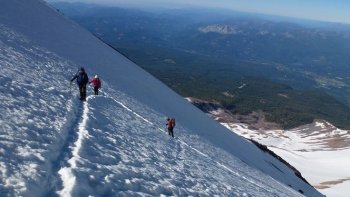
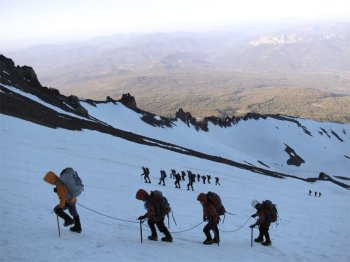
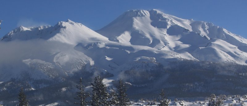
April 24, 2024 - Mount Shasta is the second highest peak in the Cascade Range, surpassed only by Mount Rainier which is just 249 feet taller. Nonetheless, with a base diameter of more than 17 miles, Mount Shasta has the greater volume. The mountain is one of the southernmost volcanoes in the Cascades, with only Lassen Peak further south. Shastina, Mount Shasta's largest subordinate peak, is the third highest summit in the range. Shasta is also one of the youngest of the Cascade's major volcanoes. This is visible in the mountain's pointed, conical cap. Other major peaks like Mounts Rainier, Adams and Hood are older and have broader, more rounded summits. The last eruption occured in 1786; the sulphur springs near the top of Mount Shasta give warning that the mountain will reawaken in the future. Nearly 7,000 feet of Mount Shasta’s height is above the timberline. Consequently, this is among the most barren wilderness areas in northern California. The lushest forest within the boundary is found on the northeast and southeast slopes of the mountain. Glaciers, tundra and massive screefields dominate the rest of the area, although small meadows punctuate the lower flanks of Mount Shasta. The wilderness area also contains several lava flows, most of which are found on the north side of the mountain. The newest flows are in the northwest, nearest the Bolam trailhead. Older flows can be observed in the North Gate area. Over 15,000 summit attempts are made every year, only a third of which are successful. Avalanche Gulch is the least difficult and most popular route, and many people with no mountaineering experience are able to climb it (many more such people are not). An ice axe and crampons are necessary for all routes. One-day ascents are possible, but beginners will want to take two days so they can have more time to acclimatize.
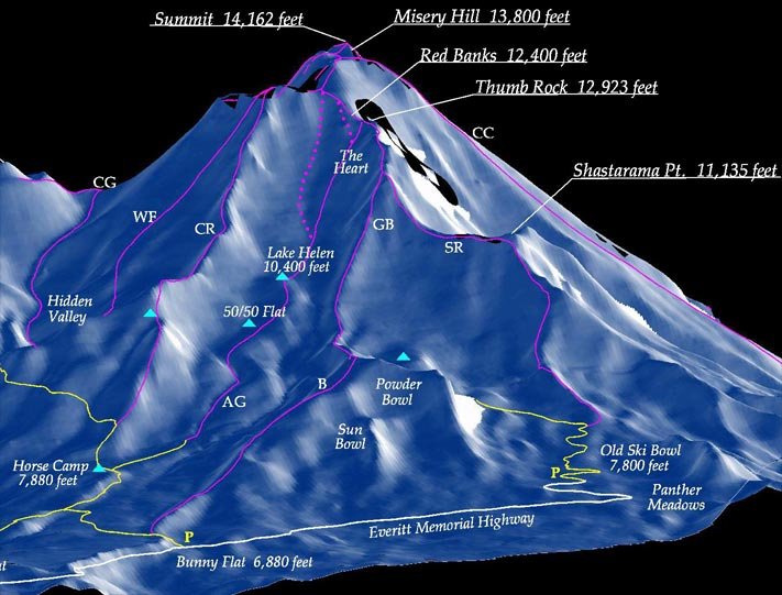
          0.0       6880'  Bunny Flats - start Zero Dark Early
             1.7M     7880'  Horse Camp Lodge - last place for running water
             2.75M    9200'  50/50 Flat - snow begins above treeline - go to crampons
             3.5 M  10,400'  Lake Helen campground
             4.2M   12,800'  Red Banks after 2200' ice wall in less than one mile
             4.5M   13,200'  Misery Hill after crossing glacier, less steep
             5.0M   13,900'  Base of Summit - windy
             5.2M   14,179'  Summit
                      glissade back
Useful
phone numbers: The
Sierra Club Lodge approach via Bunny Flat is the most popular approach.
Avalanche Gulch, Old Ski Bowl, Sargents Ridge, Green Butte Ridge,
Casaval Ridge and Cascade Gulch are accessible from Bunny Flat. From
Interstate 5 in Mount Shasta City take the central Mount Shasta exit
onto West Lake Street and continue about a mile until it bears left
and becomes N Washington Drive. The road soon turns into Everitt Memorial
Highway and leads directly to Bunny Flat at elevation 6950 feet, 12
miles from the interstate. From the trailhead take a two mile trail
to Horse Camp (7900 ft) for all Bunny Flat routes except Green Butte
and Sargent’s Ridge. Climbing
Permits: Wilderness
Permits: Human
Waste Pack-out Bags: Trailhead camping is common and allowed at the Bunny Flat trailhead. Dispersed camping is allowed throughout the greater Mount Shasta area, including at and en route to other trailheads. Camping is also allowed at the Sierra Club maintained Horse Camp. They charge $5.00 per tent and $3.00 per bivy. This is a good basecamp for trips up many of the south side routes. The Forest Service maintains two campgrounds on Mount Shasta, both of which are located off of Everitt Memorial Highway. McBride Springs Campground is only a couple miles outside of the town of Mount Shasta and has a lot of shade. Panther Meadows Campground is located near 8,000 feet, just a bit below the Old Ski Bowl. 
|
 Climbing Mt. Shasta, California