Climb Mount Shark, Kananaskis - Alberta, Canada
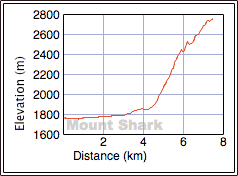
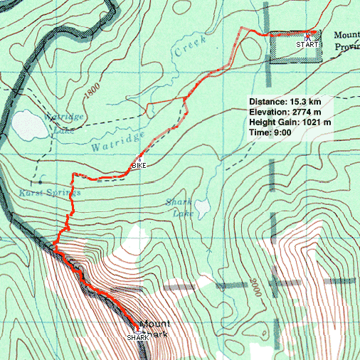
Elevation Gain: 3350'.......... Summit: 9141'........Distance: 15km / 9 hours RT
July 11, 2017 (Tuesday)
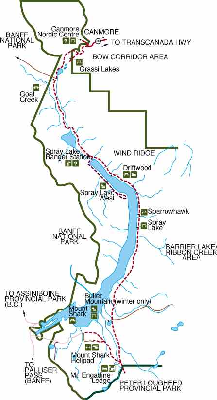
GETTING THERE: From the Canmore Nordic Center, drive 36 km south on the Spray Lakes Road (gravel). Turn right at signs for the Mount Shark Cross Country and Biathalon Range as well as the Mount Shark Helipad. Follow this road 6.4 km to a parking area at the end. Check for Bear and Lion Advisories/Closures ahead of time. There are tons of camping options further north at Kananaskis Lakes. You cannot camp outside of the marked specific camping areas in Kananaskis. Take helmet, compass, ice axe and bear spray. No permit required.
From the Lost Lemon Mine pull off just 4.4 km south of the Highwood Pass parking area, continue north on Rt 541 for 50-60k before turning west on gravel road to Peter Lougheed PP and Spray Lakes. Past the Mt. Engadine Lodge on left turn west toward Mt. Shark Heli Pad; follow 6.4k to end of road parking.

Last week we turned back on Mount Shark because of the threat of a thunderstorm (no trip report). We wanted to try again, but I was put off by the bushwhacking and navigational problems using the book approach. I figured there must be a better way. We found it on our descent. Since our alternative approach avoids Watridge Lake, it's shorter and incurs little elevation loss. It also adds some scrambling. Also, unlike Kane's approach, there's is only light bushwhacking – short trees you can see over – so you can keep your route in sight. There's no chance of getting lost in the trees!
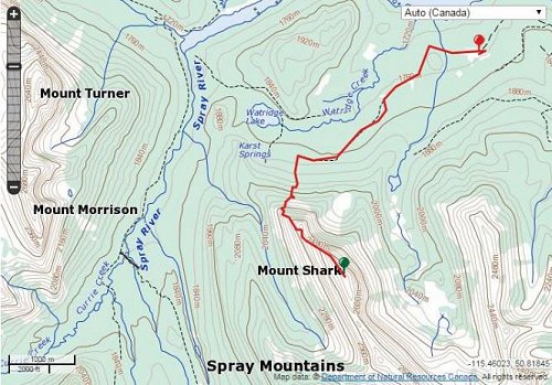
We cycled up the main trail for 1.3 km before turning left onto a logging road that looks like a wide, grassy corridor. After the road does an "S" bend, it straightens out and Mount Shark lies ahead. We managed another two kilometres before stopping at an old weather station. The road degrades after this point so we set off on foot.
As we hiked up the road, I was dismayed how rapidly and utterly it degenerates. In some places, logs, streams, and vegetation hindered our progress. When we were adjacent to an open rocky drainage, I was tempted to bushwhack to it. Instead we pushed on, in hopes of avoiding any bushwhacking by ascending a drainage that I had seen on Google Earth. That turned out to be a mistake, and we had a miserable time bushwhacking to the treeline. However, that rocky drainage that we passed remained on my mind and we used it on the descent.
After emerging onto the open slopes we ascended left of the ridge. When we were able to, we crossed over the crest. I would have liked to continue up the slabby ridge, but because of the strong winds, we decided to drop below the slabs and make our way to the col that splits the ridge of the mountain.
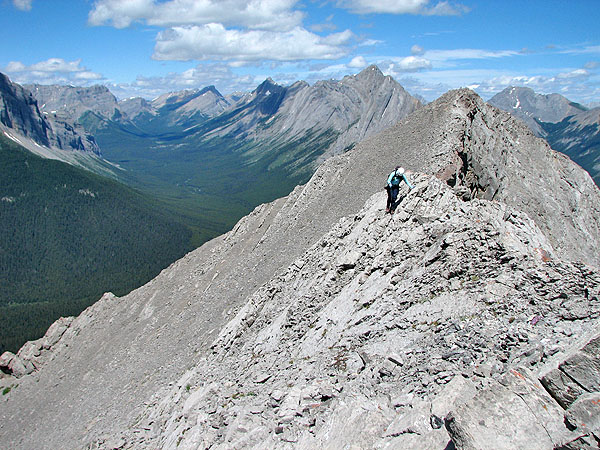
Mount Shark shows its teeth if you stay close to the ridge. The scrambling is sometimes difficult and exposed, but routefinding is simplified because of the well-worked trails. Yet avoiding the difficult sections to do a moderate scramble requires psychic routefinding. It's hard to discern where you'll encounter difficulties, or the best way to avoid them. We stayed close to the ridge, which would have been enjoyable save for the wind. Just before the summit we had to downclimb a chimney.
After relaxing on the summit, we retraced our steps back to the treeline. I didn't want to go through the bushwhacking hell we had done on our ascent, so from the treeline, we worked our way east around the end of the ridge. We angled down but stayed near the treeline. This led us to the rocky drainage we saw earlier. We had no difficulty descending the drainage, although at one point we did have to traverse high to avoid some slabs.
At the bottom of the drainage, the rocks gave way to a mix of short trees and bushes. We were pleasantly surprised to find the vegetation was thin and free of deadfall. In comparison to the morning's bushwhacking, it was a quick and pleasant walk. If only we had used this route on our ascent!
Much of the old logging road is a pleasant, wide corridor
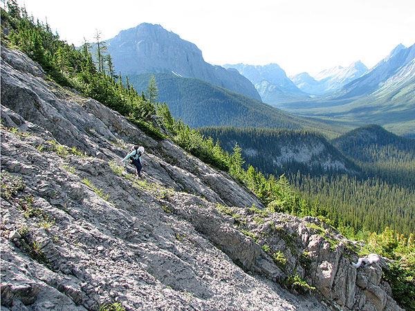
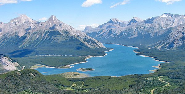
Watridge Lake seen from the lower slopes
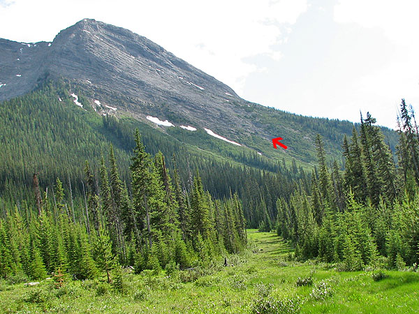
Our ascent route was too bushy to recommend, but our descent route was fine
After gaining the ridge from the east side we crossed over to the west side
Instead of following the ridge, we dropped down below the slabs, ascended left of the snow patch and
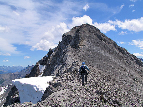
then traversed to the right. This easy scramble took us to the col after the first fin of Mount Shark.The false summit seen from the col
The ridge after leaving the col
One of the trickier sections
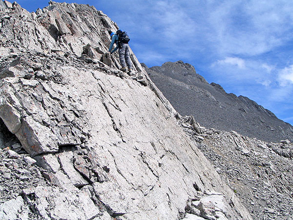
The summit cairn lies ahead. What can't be seen is the difficult,exposed scrambling before it.
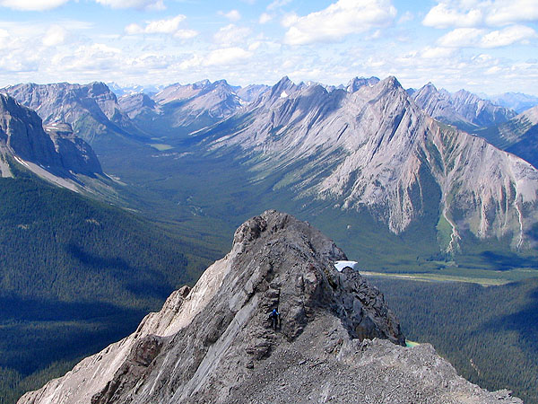
The chimney seen from the summit
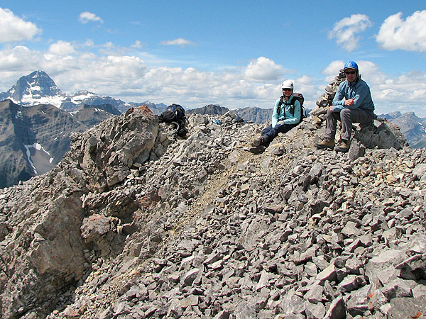
On the summit of Mount Shark. On the left, Mount Assinniboine rises above other peaks.More exposed scrambling
From the col, we returned the same way, below the slabs
We reached the rocky drainage that will take us back to the logging roadLooking back up the drainage
View of the drainage from the logging road