Rim to Rim to Rim in the Grand Canyon - 46 Miles - 16 hours
Sunrise 0538 / Sunset 1914 / under a New Moon
South Rim to River: 4800'                North Rim to River: 5850'

Current Updates on GC Trail Maintenance

@ Tuesday, April 18
Trail maintenance is still not complete on the North Kaibab Trail.  Scheduled closure each day is between
0800 and 1630.  All indications are that things will be the same on April 29, meaning we should probably
not begin before 1030, allowing a leisurely 6 hours to reach the Redwall after the work crews have left.
We will get a final update on Friday, April 28 from the rangers.  Temps should be in the 50's-60's to start on SK,
80's-90's at Phantom Ranch at noon, and back to 50's-60's at the top of NK by 1800.  Returning to Phantom
Ranch by 2100-2200, temps should still be at least 70.  Finishing between midnight and 0200, temps
could get back down into the 40's, so bring a fleece along with a good lamp.

I recommend everyone read this report from April 15 to get a feel for where you can get water and
what general conditions to expect.  Also check the Current Updates above and the weather forecasts
below before  you arrive.

Weather Forecast for South Rim       HourlyGraph      Weather Forecast for Phantom Ranch
Average temperatures for the South Rim are: Apr 29, high 70 / low 39
Average temperatures at the North Rim are: Apr 29, high 62 / low 34
Average temperatures on the floor of the Grand Canyon range as follows: Apr 29, high 91 / low 62

If you are on FaceBook be sure to join Benedict Dugger's "Grand Canyon R2R2R Run" Public Group
as a resource for the latest updates on all things R3.
Saturday, April 29, 2017
THE PLAN: Friday, April 28 - Meet at Mather Campground at Site 211 on the Oak Loop
where you can find me. (see MAP). My TracFone cell # is 910-986-3047.
Saturday, April 29 - Depart the CG by 0500 for 1.5M jog over to the start at the S. Kaibab TH
Leave vehicle at CG and tent set up for after the run.
No Permit or Sign In Required
After group photo, start down to the river around 0530. It is one of those runs
two or three groups separate according to ability. Walk past the mules on the
descent to the river and be friendly with the mule skinners.
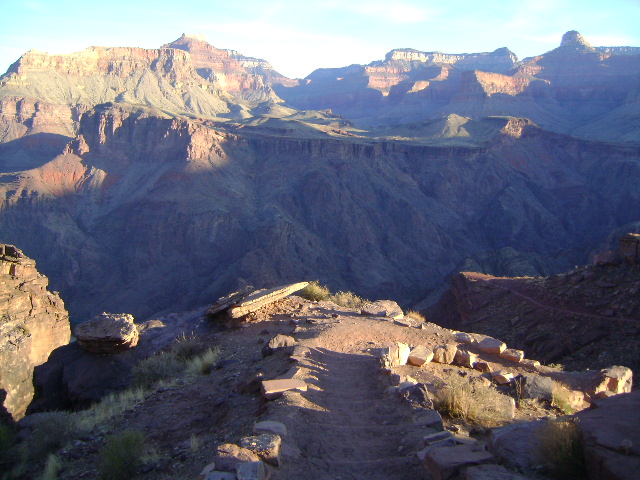
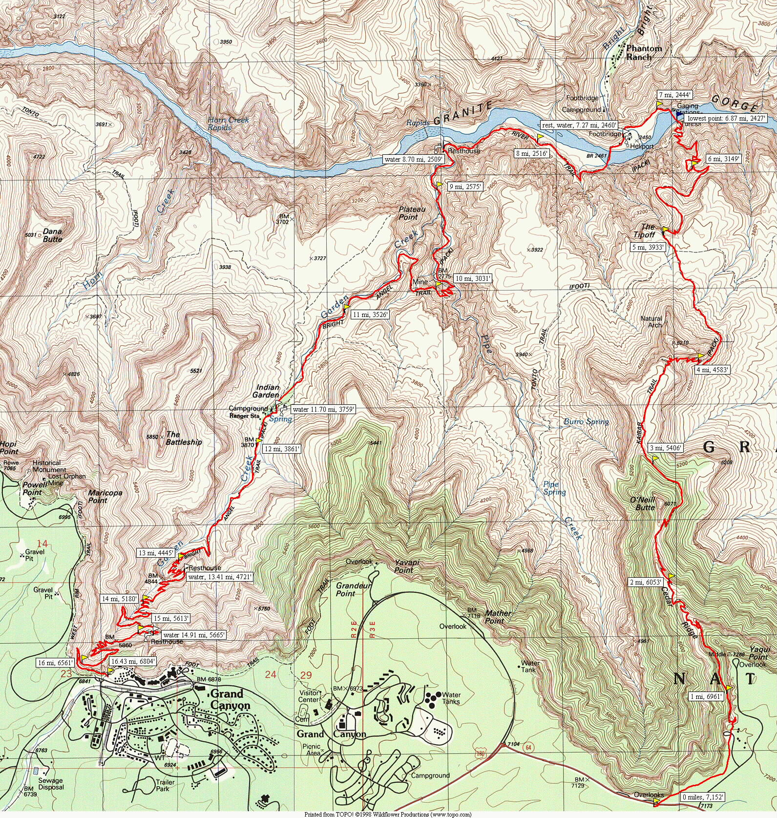
Down 7M on S. Kaibab to the River (water)
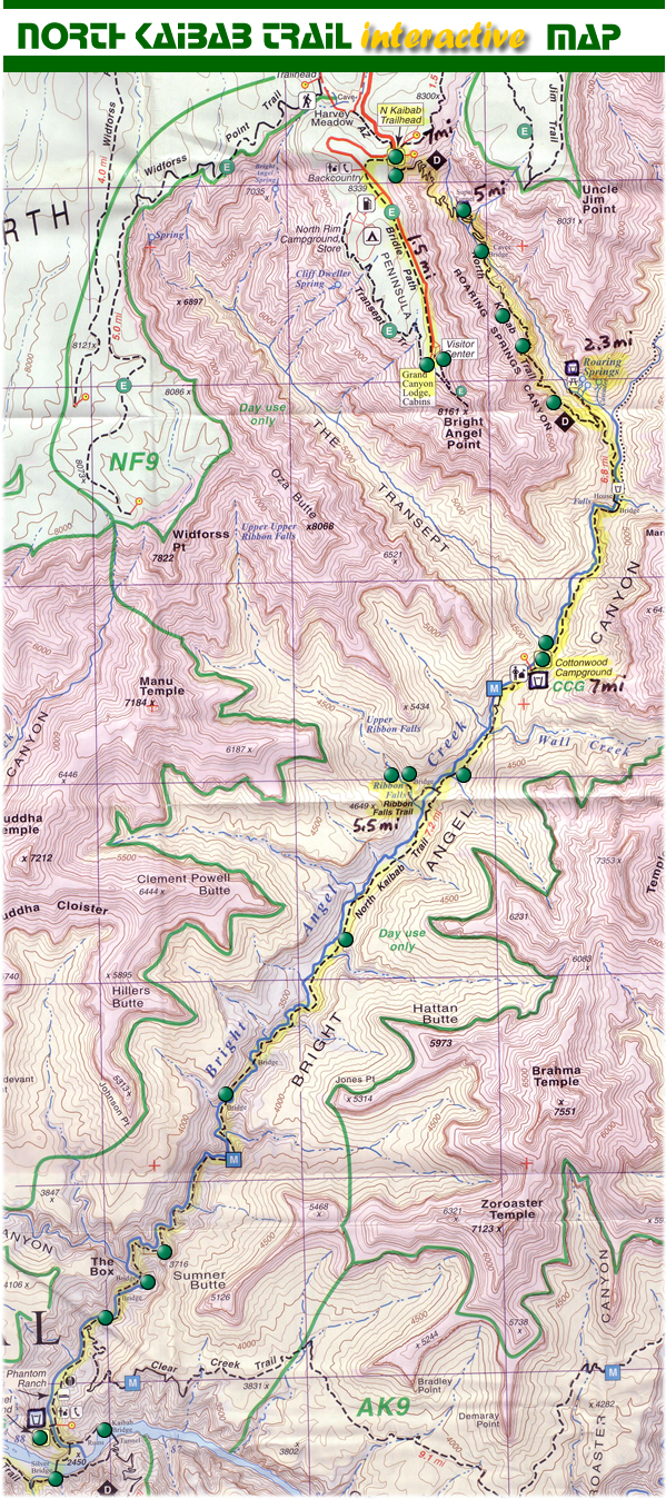
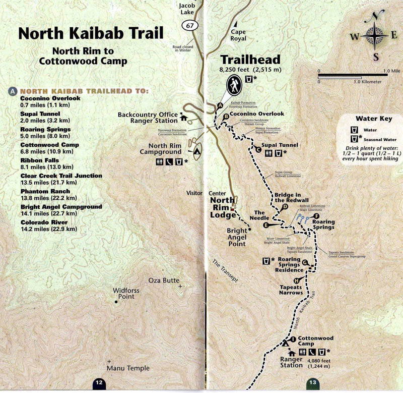
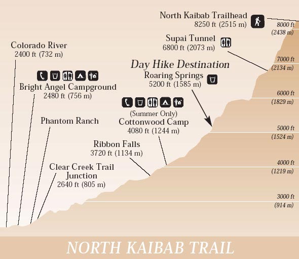
Up 7M on N. Kaibab to Cottonwood Camp (water)
Up 7M on N. Kaibab from Cottonwood Camp to the North Rim (maybe water)
Down 14M on N. Kaibab back to the River
Up 8M on Bright Angel Trail to South Rim (three water sources)
From the top catch the free bus or run the 2M back to your tent and car in the CG
Someone may volunteer to leave a shuttle vehicle in the village parking lot.
Review the four Maps with mileages at bottom of this page
Caveats: BRING A LIGHT; BRING A SHELL
CARRY THREE LITERS OF WATER on North Kaibab - Where the Water is turned on
The only water on North Kaibab will be from Bright Angel Creek or springs
BRING SOMETHING TO TREAT WILD WATER
STONGLY RECOMMEND CARRYING A SALTY SNACK to prevent
hyponatremia - chips, goldfish, pretzels - instead of S-Caps/Endurolytes
Temps may vary between 35 deg F at rim and 110 deg F at River
If temps are over 90 deg F at the bottom, slow down, take a dip in
Bright Angel Creek - seriously!
Sunday, April 30 - There are showers at the campground, but they will likely be closed before we
finish the run. I will be staying until May 1. Anyone is welcome to stick around
After a week of rest and more fun I will be heading over to Zion National Park to
do the Zion Traverse on May 6. Everyone is welcome to make it a running
vacation. See my Complete Itinerary at: http://jedirunner.com
WHO IS GOING: Fanny Barrette - Calgary, AB - Fly Las Vegas Site #202 TFSS
Shirley Fleming - Calgary, AB - Fly Las Vegas Site #202 TFSS
Lisa Arcaini - Calgary, AB - Fly Las Vegas Site #202 TFSS
Rob Pinckston - Calgary, AB - Fly - Las Vegas Site #202 FSS
April Tsosie - Cove, AZ - Drive FSS
Donna Graham-Finan - Goshen, NY - Fly Las Vegas TFSSM
Michael Monyak - Punxsutawney, PA - Drive Site #211 TFSSM
Larry Creveling - Aberdeen, NC - Drive Site #211 TFSSM
John Zeier - Vancouver, WA - Drive FSS
Calub Baybayan - Vancouver, WA - Drive FSS
George Hollerbach - Newtown, PA - Fly Phoenix FSS
Shawn Severson - St. Paul, MN - Fly Phoenix TFSSM
Gregg Lind - Minneapolis, MN - Fly Las Vegas FSS
Melissa Woods - New Rochelle, NY - Fly Las Vegas FSS
              LINKS:       TIPS FOR RUNNING R3          2014 R3 ADVENTURE REPORT           2014 R3 PHOTOS

                              GRAND CANYON TRAIL RUNNING BASICS

                              GRADIENT COMPARISONS:
          Grand Canyon - South Kaibab Trail - 7.1M - 4800' - 12.9%
          Grand Canyon - North Kaibab Trail - 13.5M - 5850' - 8.2%
          Long's Peak - Rocky Mtn. NP - 7.5M - 4803' - 12.1%
          Mt. Washington - Tuckerman's Ravine - 7.9M - 4368' - 10.5%
          Grand Tetons - Paintbrush Canyon - 7.6M - 3863' - 9.6%
          Pikes Peak - Barr Trail - 14.0M - 7700' - 10.4%
          Sandia Crest - La Luz Trail - 8M - 3775' - 12%
          El Vaquero Loco start/finish - 4M - 3000' - 14%