July 20, 2016
|
Mount Lindsey
Northwest Ridge
APPROACH:
From Denver drive south 2.5 hours to exit 52 to Walsenberg. Take
a quick turn west on Colorado 69 and follow it west for 25.1 miles
to Gardner. A bit past Gardner turn west on 69 toward Redwing and
Mosca Pass. There should be brown Forest Service signs on CO 69
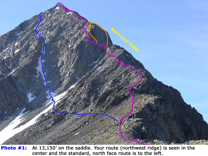
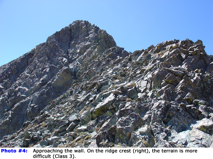
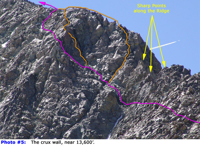
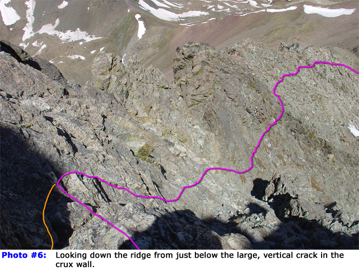
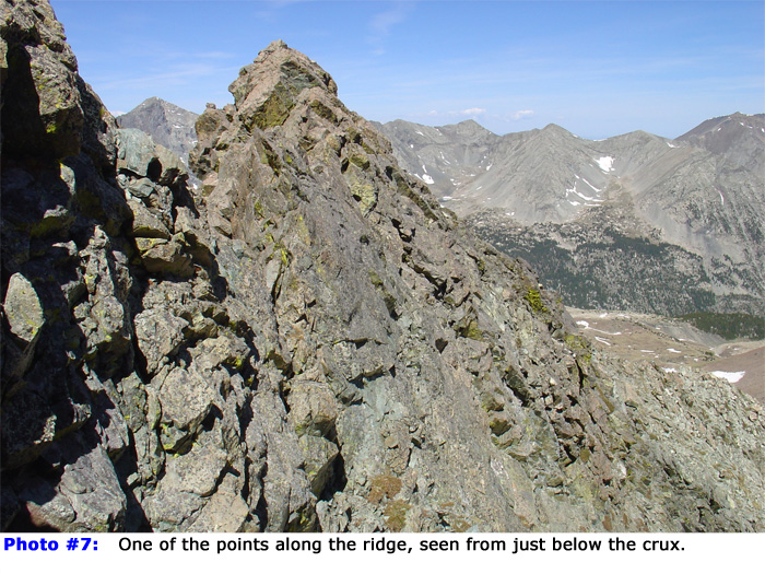
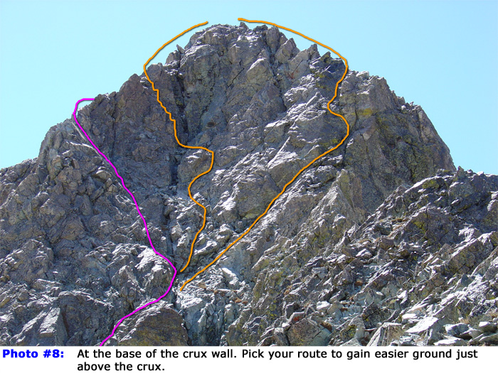
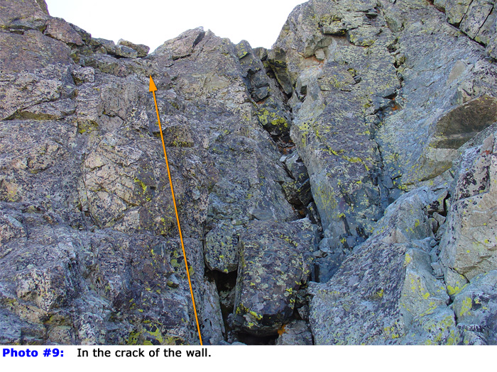
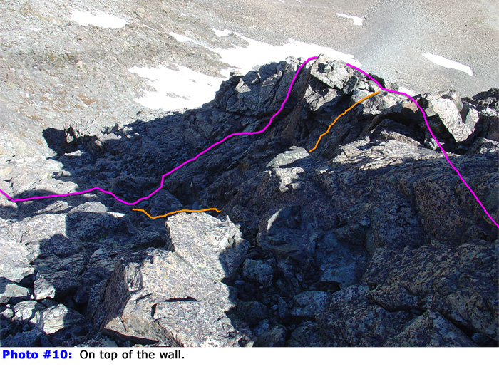
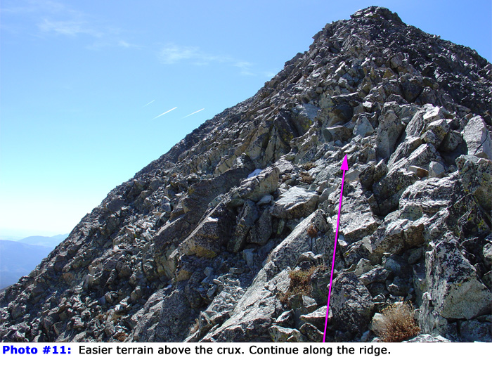
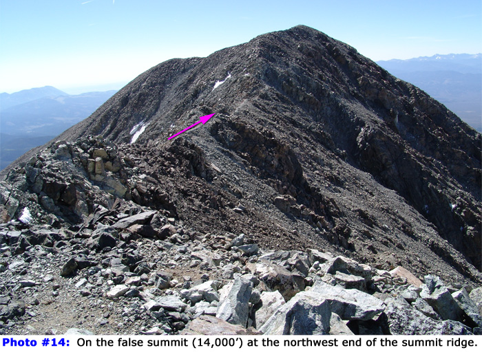
indicating the turn. ROUTE: This is one of the harder Colorado 14ers to summit. First, follow Mt. Lindsey Route #1 to the 13,150-foot saddle between Iron Nipple (13,828') and Mt. Lindsey. From the saddle, the northwest ridge is in full view and may look intimidating to some. More than 1/2 way up the ridge a crux wall makes this route more difficult than the standard, north face route - Photo #1 and Photo #2. Finding a Class 3 line around the crux is possible but many climbers simply take a direct, Class 4 line up the brief pitch. Hike southeast along the ridge on a small trail and near 13,200', where the trail turns east toward the north face, stay right and continue up the northwest ridge. As you climb higher, the terrain becomes more rugged and requires some Class 3 scrambling, especially on the ridge crest - Photo #4. As you scramble toward the crux wall - Photo #5, it's clear that the route is becoming more serious. Scramble across a steep area below the ridge crest, down to a notch and up to the base of the crux wall. Photo #6 and Photo #7 were taken in this area and show some of the rugged terrain features. Photo #8 is a head-on view of the crux wall, showing several options. One way to keep the difficulty at (exposed) Class 3 is to bypass the wall on the left side. If you choose this option, regain the ridge right after the crux wall to avoid loose terrain. If you're comfortable with brief Class 4 climbing, the best option may be just left of the large, vertical crack in the center of the wall - Photo #9. Carefully pick your line and regain the ridge on easier terrain - Photo #10. Above the crux, continue up the ridge - Photo #11. Continue to the 14,000-foot false summit on the northwest end of the summit ridge - Photo #14. Hike southeast for nearly 0.2 to reach the summit. Difficulty:
Class 3
|