BLESSING FROM THE PRIEST - Tyro, Virginia
June 18, 2015
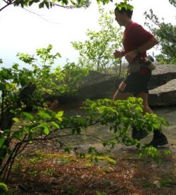
This run is regarded by many as the ultimate hill workout for big western 100s like
Wasatch or Hardrock. Elevations range from 930 feet at the trailhead along the
Tye River to 4,063 feet at the Priest’s summit, with a quad-burning climb of over
3000 feet in a mere four miles. I needed some sharpening on my climbing skills
on my transit to the Catskills of New York, so stopped just south of Charlottesville
to climb the iconic Priest to get a blessing from the mountains before the
unquestionably toughest trail running challenge that may await me this year.

After three climbs of 3500 feet in three miles each at Quest for the Crest less than
three weeks ago, this would not be my most severe challenge, but it would be a
good test of where my climbing strengths and weaknesses lie.  It is good to
know your limitations prior to one of these contests, so I went to the Priest to
seek its blessing.  To preserve energy I would hold on doing the Three Ridges loop
for another time.  I was excited to see this country up close, only looking at it
from the Blue Ridge Parkway with wanton desire prior to now.
* * * * * * * * * * * * * *
THREE RIDGES LOOP and THE PRIEST 22.5M, Virginia AT
7800' Vertical Gain
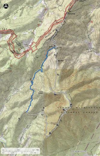
The run consists of a 14 mile loop of the Appalachian Trail and Mau-Har Trail, which takes you up and over Three Ridges. This is followed by a 9 mile out-and-back up the Priest, whose ascent gains a quad-burning 3,000 feet in just 4 miles. Climbs like this are rare indeed in Virginia.From the trailhead off of Route 56, take the white-blazed Appalachian Trail (AT) north across the road and across the Tye River, and begin the ascent up Three Ridges. In 2.0 miles, come to the intersection with the Mau-Har Trail (you will return on this trail). Stay on the AT, and enjoy several spectacular views of the Priest before reaching the summit of Three Ridges (3,790 feet) at mile 5.9. Continue on the AT for 2.8 miles, descending to the Mau-Har Trail near Maupin Field Shelter. Take a left onto the blue-blazed Mau-Har Trail for 3.3 miles before intersecting the AT. Take a right on the white-blazed AT and descend 2.0 miles back to your car. This first loop is 14 miles.The finale is the 3,000 foot ascent of the Priest. Take the white-blazed AT south and climb for the next 4.0 miles before reaching the summit plateau. The turnaround is the turnoff to Priest Shelter.
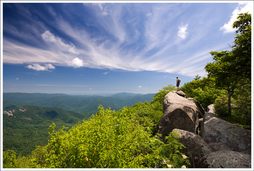
View of the Priest from the Three Ridges Wilderness
FKT
Run Details
VHTRC
:19:52 from the AT trail map board to
AT/Mau Har intersection.
:46:15 (1:06:07) to Three Ridges summit.
:22:42 (1:28:49) to Mau Har intersection.
Refilled water bottle at the spring here
and took a scratch shortly after.
:32:54 (2:01:43) back to Mau Har/AT intersection.
:12:11 (2:13:54) back at the car lot/trail
map board.
:01:16 (2:15:10) switched out bottles
and back on the AT, up The Priest.
1:02:35 (3:17:45) tippidy-tapped the shelter
wall. I lost a chunk of time on the climb.
Running up a mountain on un-fresh legs
is challenging, to say the least. Excuses,
excuses...
:35:23 (3:53:10 finish) Priest re-summit
and down to the AT trail map board. FKT
reset. Running hard down a mountain on
un-fresh legs is much more doable.